
Know Your Flood Risk
All Gretna properties are at risk of flooding from rain, which can occur during any season of the year. In the late summer, hurricanes also pose serious threats.
Make a plan so you can be prepared if the water rises.
How Flooding Occurs
Flood water collects because much of Gretna lies at or below sea level with land prone to subsidence or sinking. Water is conveyed out of the city through a series of pipes and canals using gravity drainage. During extreme rain events, such has heavy thunderstorms or tropical systems, the drainage system may be temporarily unable to convey enough water to prevent flash flooding. The city is protected from Mississippi River flooding by the levee system maintained by the Southeast Louisiana Flood Protection Authority.
| Access the Gretna geoportal here to view a map of base flood elevations. | |
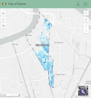 | When viewing the map, click on the “Layers” menu and turn on “FEMA Flood Zone Depth 2021” to see projected flood depths |
A History of Flooding
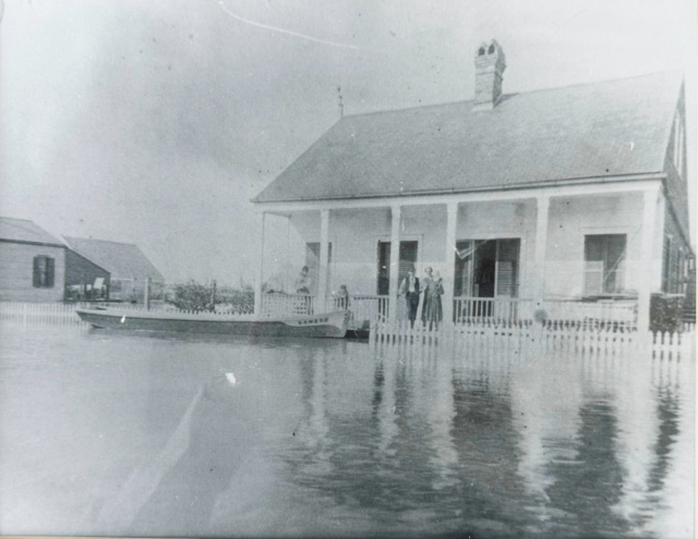
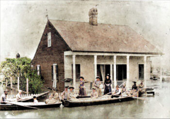
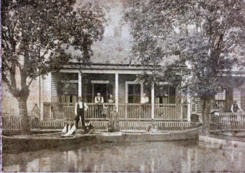
The Great Crevasse, 1891
Gretna has experienced flooding throughout its existence. During the Great Crevasse in 1891 a breach inadvertently created in the Mississippi River levee grew to more than 1000 feet, flooding much of Gretna and Algiers. In the great flood of 1927, flood waters rushing down the Mississippi River from the American heartland inundated much of south Louisiana.
In more recent times, 5th Street was flooded by Hurricane Edith in 1971. In 2005 Hurricane Katrina brought additional flooding to the area, followed by Hurricane Isaac in 2023. In addition to these high-profile disasters, much of the historical flood losses are caused by heavy thunderstorm events.
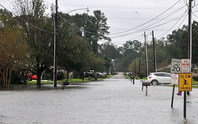
Gretna,LA, August 30,2012–A road in Gretna, LA is flooded after Hurricane Issac dumped rain in the area. Photo by Patsy Lynch/FEMA
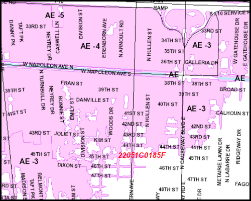
Determine your Flood Zone
Due to the fact that much of the land in Gretna is low, your property may be in a Special Flood Hazard Area as determined by FEMA through the use of Flood Insurance Rate Maps. This flood risk information is available in the Jefferson Parish Geoportal. Maps that show flood hazard areas are also on file in the Building Department at Gretna City Hall or your local library.
Understand your Flood Zone
Property owners in Flood Zone AE (high risk) are required to carry flood insurance if they have a federally backed mortgage. For properties in Flood Zone X, flood insurance is highly recommended as flood do not respect zone boundaries. Facts shows that 20 percent of all flood insurance claims through the National Flood Insurance Program and receive one-third of federal disaster assistance for flooding.
Information About Past Floods
Click here to view a map of areas that flooded during Hurricane Katrina in 2005.
Inundation Maps
The inundation maps below illustrate the various levels of flooding predicted for different flooding scenarios (Jefferson Parish data).
- Flash Flood Inundation Map – Level 1
- Flash Flood Inundation Map – Level 2
- Flash Flood Inundation Map – Level 3
Subsidence Information
Flooding can also be exacerbated by subsidence, the gradual sinking of the land affecting southern Louisiana. This memo provides map information on project subsidence rates in Gretna.
Access the Jefferson Parish Geoportal – Flood Maps
The LSU AgCenter’s Flood Maps Portal provides additional information on flood risks by address.